No, I didn't make the first part of that title up. I pinched it from a travel brochure, but I thought it perfectly fitted the ten days we spent exploring the Eyre Peninsula. We loved every minute of it (except, I must admit, the days when the temperature soared to 42°).
We had researched our proposed trip for a few months and were a little apprehensive. The brochures we consulted spoke of wild coastlines, natural beauty, ancient landscapes, endless beaches, culture, art and scrumptious seafood - all the things we look for in a holiday. However, we also read that the peninsula is a holiday destination for families with lots of camping and caravan parks, a playground for fishing and boating, the best oysters on the planet, shark cave diving, and an essential - a 4WD. All of these did not capture our imagination nor suit us. So we plotted and planned, came up with an itinerary, booked our accommodation and waited for our departure in early autumn - Thursday 13 March.
We had a wonderful 10 days. Memories remain of rocky limestone plains with stunted scrub, spindly multi-stemmed eucalypts, cypress pines, and windblown tussocks of spinifex and acacias. Of vast wheat fields stretching to the horizon. Of the wild west coast with its rugged cliffs, surging seas and hidden coves. Of delicious seafood. Of the stories of the Aborigines who have called this place home for thousands of years. Of the history of the early pioneers and seafarers. And best of all, of the welcoming friendliness of the people.
We did an anti-clockwise swing around the peninsula, so I'm starting with the northern top then we go down the western side. I always love a map so here it is.

Across the top
Port Augusta: We set off from home in high spirits, travelling the Northern Expressway, Port Wakefield Highway and the Augusta Highway to our first destination, Port Augusta, which we reached after about 5 hours. The city is situated at the tip of the peninsula, where the Spencer Gulf ends and where the ancient Flinders Ranges loom in the distance. Its position on the Eyre Highway which links east and west Australia has given it the title of the 'Crossroads of Australia'.
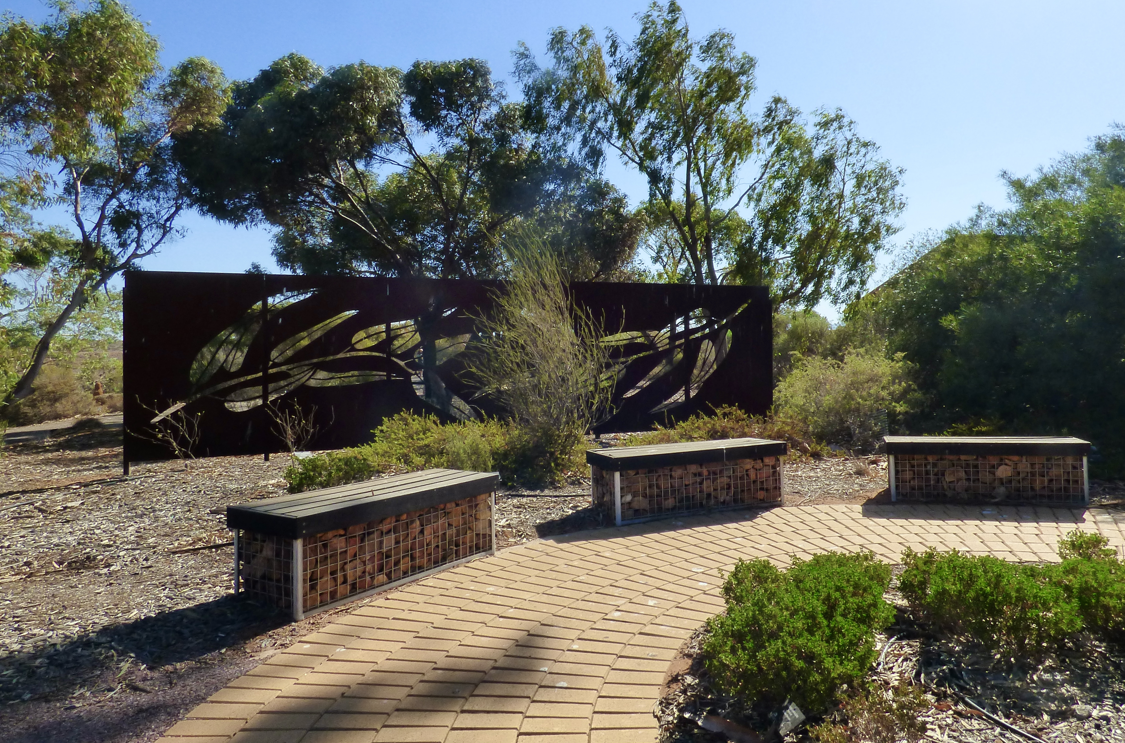
Our first stop was the Australian Arid Lands Botanic Gardens, a place everyone told us was a 'must see' as the gardens preserve and conserve plants from arid zones from all over the continent, not just in South Australia. If you need proof that Australia's desert regions are definitely not barren and devoid of life, then this is the place. The gardens are well laid out with several different walks focussing on specific plantings. We chose the Highlights Walk that included the significant eremophila collection, planted to attract birds, and a bush food section that included medicinal and food plants. There was also plenty of rest stops, which we took advantage of as the temperature started to climb.

Everything was well signposted with clear descriptions of the plants we were looking at, and explanations of how they conserved water and spread their seeds.
There were some artistic sculptures placed judiciously around the gardens.

It felt good to stretch our legs after our long drive. We strolled along admiring the diversity of plants and listening to the intermittent warbles of birdsong...
... and taking photos.
We were there at the wrong time of the year for flowers, but I spotted a few. The gardens must be a fabulous sight in spring.


A refreshing pause at the garden's café and it was now time to leave Port Augusta and drive the Eyre Highway to our overnight stay at
Wudinna (pronounced Wood-nah). It was well over 200 kms away. One town we passed - Kimba - is exactly equidistant between Sydney and Perth, so they call themselves 'The Centre of Australia'. Fair enough.
It was hot, hot, hot and after a quick stop at the Wudinna bakery (who doesn't love a country bakery), we spent the better part of the afternoon in the hotel drinking ice cold beer and chatting to the very friendly locals as the temperature soared to 42°.
The next morning we were up early, eager to explore Pildappa Rock just outside the Gawler Ranges National Park and another 'must see'. It's similar to WA's Wave Rock and we enjoyed our time there, walking around it and discovering its fascinating curves and textures.
 |
| As you can see, the southern side was cooler and darker in the shadow of the early morning light. |
The West Coast
Our next destination was
Streaky Bay on the far west coast where we were to stay for two nights.
Our brochure says it was first sighted by a Dutchman in 1627, but it was our friend Matthew Flinders who named it in 1802 because of the streaks in the water across the bay - caused by the reflection of light on the seaweed. It wasn't until explorer John Eyre arrived in 1839 that the township was established. We're staying in a lovely balcony room at the hotel, thankfully air conditioned because, guess what - its still 42°. So more beers at the pub. The next morning we organised ourselves and set off very early on the Heritage Walk round the town, determined to see more of the place other than the hotel bar. Though I must say my dinner that night of Spencer Gulf prawns in an oozing garlic cream with rice was absolutely delicious.
 |
A more 'modern' home from the 30s.
|
We met a man with a dog, out for an early morning walk. Chatted way. He regaled us with places we should see and things we should do, clearly happy to share his love for his home town.
I liked the way the town acknowledges the past yet embraces the new.
 |
| And another local. |
Our travel brochure mentioned two coastal drives. Off we went, careful to take a supply of water and our hats as the temperature remained in the 40s. The first drive, the Cape Bauer Loop was on a very rough road but we persevered until we finally reached the Whistling Rocks and blowholes. A very long and steep staircase took us across a rocky ledge to the cliff top where we could see the waves pounding into the jagged rocky cliff and sending air up through holes in the rock causing a hollow whistling sound. Quite eerie.
 |
| Here are the surging waves just about to strike the rocky ledge. |
Next was the
Westall Way Loop, an easy drive with lots of opportunities to stop and view the cliffs, beaches, and rocky shoreline. It's still hot but there's a welcoming sea breeze.
A little further south we came upon
Yanerbie with its lovely beach.
But this photo doesn't reveal how stinking hot it was with, by now, a fierce wind blowing, so we continued on north to
Perlubie Beach, only to find you had to hire and pay for a shelter (all were taken) and even our walk to the water had us aching for a cool beer and an air conditioned room. However, a lovely lady said we could share her family's shelter for a while. We thanked her, but left.
That evening we went to a local restaurant for dinner - and a Quiz Night. When we booked and were invited to attend, we thought it might be a fun diversion. We were on a table with two Victorians, two Queenslanders and a local. Well... all was going swimmingly as we aced 'Australian History', 'World Moments', 'Geography' and 'Movies'. But we sadly came unstuck with 'Pop Culture', 'Matching celebrities to endorsed products', and two rounds of 'Sport'!!!!! But Steve did win a bottle of wine for knowing that Val Kilmer played Jim Morrison in the movie
The Doors. As we were discovering, Eyre Peninsula people are happy, friendly and fun.
And our souvenir of Streaky Bay was a large bottle of gin from one of the local distilleries. Its description reads: Paying homage to the tenacious flora that thrives in the arid Streaky Bay climate our gin with salt bush and kaffir lime has a herby citrus aroma with earthy undertones.
We can't wait to try it.
Thankfully there was a cool change for our next day of adventure. It was cloudy, so much cooler and only a trifle windy. Hurrah. Heading south, we stopped at one of the peninsula's top tourist attractions known as Murphy's Haystacks (the story being that back in the 1800s a visitor saw what he thought were haystacks on a farm, and the name has stuck). What he actually saw were inselbergs - upthrust granite rocks that have been eroded over millenia and now remain isolated from the surrounding landscape. A geological oddity, inselbergs (German for 'island mountain') are found in various places of the world, generally in hot dry regions. These ones on the Eyre Peninsula though are smaller and clustered in groups, unlike other examples which are bigger and resemble a single large rock, such as Australia's Uluru. We spent a long time exploring these fascinating shapes.
 |
You can see how cloudy and gloomy it was.
A perfect atmosphere for exploring these immense geological formations. |
 |
| Couldn't resist a wave. |
 |
The sun is beginning to shine. |
Invigorated with our exploring of this fascinating site, we drove further south to
Venus Bay. Here, we took a coastal walk called the South Head Walking Trail. My diary records: '
What can I say? Fabulous, exhilerating, spectacular scenery.' The sandy track with rocky outcrops ran close to the cliff edge, while below, the sea swirled into Venus Bay.
We kept stopping to take in the fresh breeze and seascape views.
My diary continues: 'Peering gingerly over the cliff I could see the result of endless pounding of the waves into the limestone cliff, forming mini caves, jagged rocky formations, tiny pools and, now and again, a small sandy beach'.
 |
I'm always amazed at how plants survive, and look so pretty, in this environment.
This might easily be in someone's rock garden. |

We were enjoying this walk immensely until, about three quarters of the way along, the wind started blowing more fiercely, sand began to whip up and sting my arms and face, and rain began to fall. Oh dear. We hurried on gingerly stepping over rocks and around plants, cameras snuggled under our tops, until we reached the car park. Once inside the car, we felt happy we'd completed the walk without mishap.
On the road again, this time to
Elliston about 60kms or so further south. After checking into our accommodation we set off for more coastal vistas. Rugged cliffs. Offshore islands. The Great Australian Bight in the distance.
The sun had come out and it was now warm and still. Perfect for sightseeing.
The Anxious Bay Clifftop Drive was special in that it featured sculptures along the way. I loved them for their appropriateness to the area and their quirky nature. It was fun to spot them. Here's a seahorse made of bits and pieces of metal.


 |
| A weather vane. |
The following day we continued driving south then detoured inland to visit Cummins. The landscape here was vastly different - a very flat landscape dotted with limestone rocks and stunted shrubs. We saw a number of rocky walls (referred to as 'drywalling') in this area, a cheap and relatively easy way of making a fence. However, to my mind, a lot of hard work was involved as the rocks had to be placed just so with no gaps. Still, there were thousands of rocks just lying about so a ready supply on hand.
Then we passed a large lake which actually had water in it, some smaller lakes which were really salt pans, and paddocks of sheep. We didn't actually do much in Cummins as we'd just had breakfast but I did admire the mosaic on the toilet wall. The town is a large regional transport centre for the area's wheat, hay, grain and stock feed industries, so lots of huge trucks about.
Onward to
Coffin Bay, the most southerly town on the west coast, which we reached in about two hours. It was named by Flinders after Sir Isaac Coffin who had been responsible for outfitting Flinders' ship the
Investigator, so not a ghoulish place after all.
 |
| A peaceful if somewhat monochrome photo of Coffin Bay. |
The oyster industry is big here. The original oyster beds were well and truly fished out by the 1890s, but oyster farms were established here around 1970 and the industry has since taken off.
 |
| A glimpse of some oyster beds. |
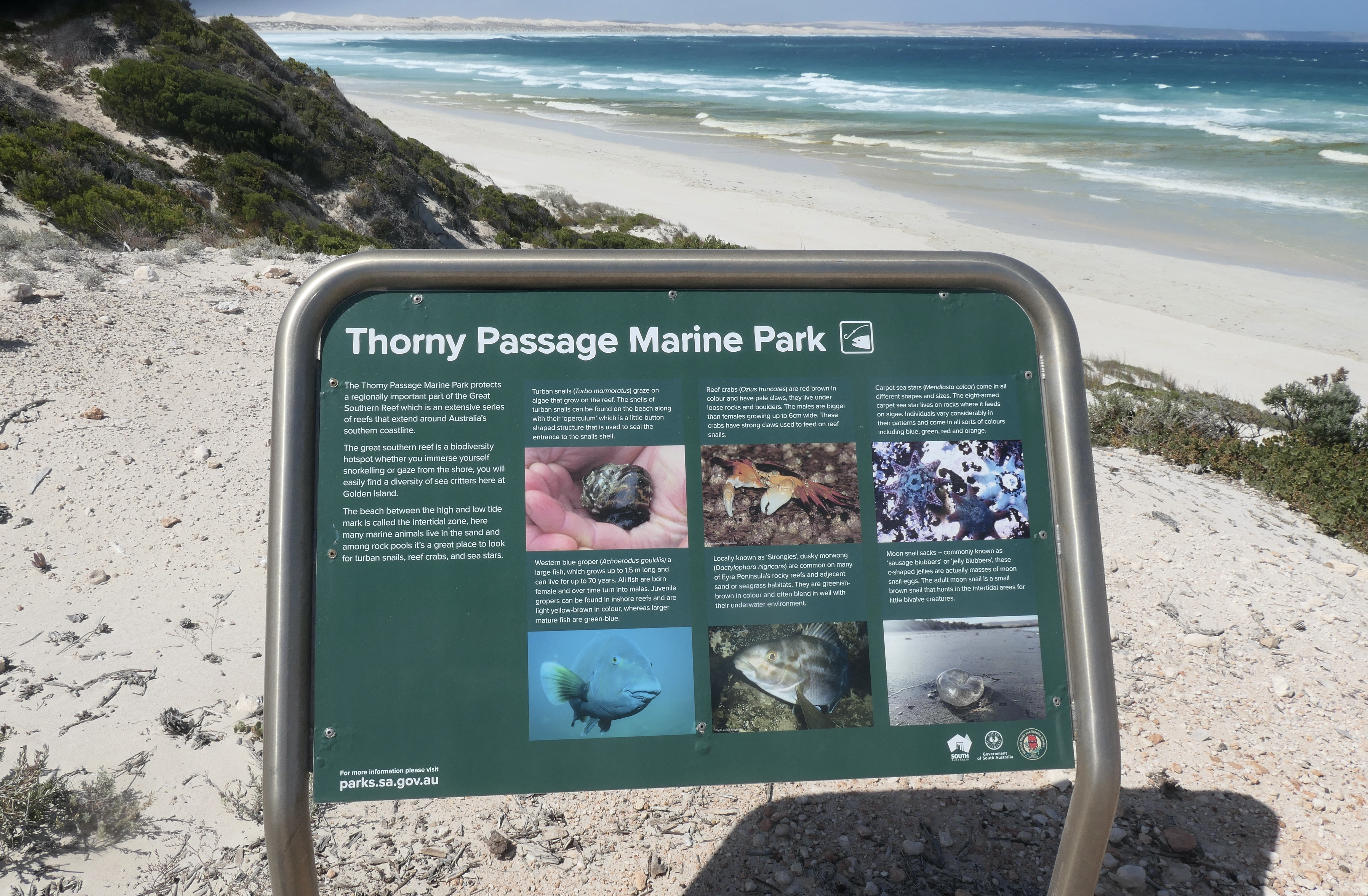
But we were keen to get to the Coffin Bay National Park. The main sealed road through the park was wide and seemed newly-made, a pleasure to drive on. There were viewing lookouts along the way from which we could see small islands, mountains and huge white sand dunes. Onwards to Avoid Cape, a headland pounded by heavy surf.
In the distance were a number of offshore islands, and lots of signs giving us information about the marine conservation parks that have been established here and the type of birds, sea animals, reptiles and native plant life that abound and are protected by law.
It was very windy (as you can see by my hair!) That's Golden Island in the distance.
A walk we really wanted to do was listed as the Yangie Bay walk. Unfortunately for us, while it began ok, it became little more than white rocks vaguely resembling a path. We turned back.
But to allay our disappointment, we drove back into town and did the Oyster Walk, a much more gentle and peaceful stroll that skirted the bay around the town.
 |
| Again, informative signs helped us understand our surroundings. |
Dinner that night was delicious. We ordered a fish we had never heard of, nannygai. A bit like schnapper we were told, and caught locally. It was fabulous. Nice and fleshy. A fitting ending to our west coast adventure.
Tomorrow we will round the peninsula and head for Port Lincoln on the east coast.
***********************


No comments:
Post a Comment