Sunday, 29 November 2015

Home sweet home

Our new home and neighbourhood is a far cry from our previous place in Portland. There we had 5 acres of orchard, lavender grove, paddocks, huge garden beds, a gazebo, sheds galore and no close neighbours...... and now we have a paved driveway, a pebble 'front garden',  a paved courtyard at the rear,  a handkerchief-sized lawn and neighbours on both sides of us in very close proximity. But how lovely it is not to see gum leaves scattered everywhere and have large swathes of peeling bark littering the driveway and lawn.  It is pure bliss to walk three steps to hang out the washing and two steps to pick my parsley. However, our new surrounds and those of the neighbouring street are indeed very, very neat.   Roses abound in all their glory and natives are pretty and well looked after - nothing straggly here. I will definitely have to lift my horticultural game. Here are three views of the neighbourhood.


There is a lovely lakeside development nearby that people kayak and swim in. Houses that front onto this lake have their own private pontoon. However, there is access to the lake for everyone with lots of landscaped grassed areas with seats at intervals around the lake.


Best of all is the Wetlands Walk, a minute from our front door. It's around 20 minutes a circuit so sometimes I turn around and do it again the other way.


Opposite our house is an old cemetery. It is fenced off with a lovely brushwood fence and native landscaping. It was once the site of the Tabernacle Church erected in 1846 by early settler the Rev Ridgeway Newland for his Congregational flock. Today half a dozen old tombstones remain; an elaborate wrought iron gate guards the entrance. It is lovely to look out of the bedroom window and see the trees, though they are home to marauding magpies and screeching cockatoos.




Tuesday, 17 November 2015

Discoveries

I have been reading an intriguing book called Ill-starred Captains: Flinders and Baudin by Anthony Brown. It tells the story of the two navigators and explorers as they charted the previously unknown southern coast of Australia between 1800 and 1803. It is an extremely detailed tale drawn from their daily journals, diaries of the sailors, and other contemporary accounts, linked together by the author's retelling of the voyages. What intrigued me was the similarity between the Englishman and the Frenchman: both were excellent navigators who put their scientific discoveries ahead of the current tensions between their countries; they died in their forties, forgotten men who were abandoned by their mentors and their governments as war between the nations became more important than discoveries on the other side of the world.

I loved following their routes, atlas close by, and identifying the landmarks the navigators named (many remain today the ones these men gave). Baudin's ships' names were assigned to Geographe Bay and Cape Naturaliste in Western Australia.  In territory close to our new home, I learned the origin of a number of names. The Fleurieu Peninsula was named by Baudin in honour of the man who gave him the instructions for his voyage: Charles-Pierre Claret de Fleurieu, who was at the time the Director-General of Ports and Arsenals. Kangaroo Island was named by Flinders  for the abundance of kangaroos found there (though the straightforward account in his journal  that the animals 'were tame and were shot in the head with small shot and in some cases knocked on the head with sticks') was particularly sad.

But the best part was finding out that Flinders actually sighted Baudin's ship on 9 April 1802 near the mouth of the Murray River at the end of a large bay, and after hauling up flags to signal who he was, went on board where they greeted each other,  talked about their discoveries and exchanged charts.  That evening, Flinders journal records that 'in consequence of our meeting here, I distinguish it by the name Encounter Bay'.  


Saturday, 7 November 2015

Along the coast

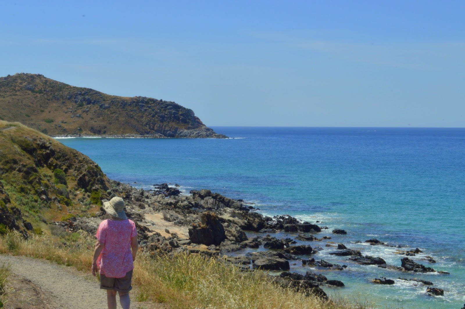
Today we walked part of the Heritage Trail along the coast near Victor Harbor. The sun was shining, the sky a vivid blue, and on our left the sea was a mix of aquamarine, bluey-green and deep indigo, with splashes of frothy white as the waves dashed against the rocky coastline.  Thankfully a cooling sea breeze wafted in as the temperature was climbing rapidly as we walked.  The gorgeous wildflowers made for a postcard-pretty picture.


To our right was farmland, a vast expanse of golden fields with masses of recently formed hay stooks.
I liked the way they looked.


We walked for an hour or so then turned back.


Tuesday, 27 October 2015

We discover an ancient rock

Last weekend we drove through the delightful Inman Valley only 15 minutes from home: a winding tree-shaded road, rolling green fields, grazing cattle and sheep, a yabbie farm... and a 270-million-year-old rock.

The valley itself was created as giant sheets of ice flowed north from Victor Harbor during the late Carboniferous/Permian period, back when Australia was still part of the super continent Gondwana (yes, I got that from the interpretive sign).  As the ice eventually melted, huge boulders were left behind, including this one that's regarded as one of the largest glacial pavements in the world; it clearly shows all the striations and gouges that the glacier ice made. The rock was discovered and recognised for what it is in 1859.


I then tried to be creative with my photography, and focussed on the reflections.


After viewing the rock from different viewing spots, we rested in the grounds of the Rock View Cafe and demolished a Devonshire tea.  Rock viewing can be very strenuous!

On the way back we passed an old property.


Monday, 26 October 2015

On the Talisker Trail

A couple of weeks ago we drove to the south-west tip of the peninsula. I love the coastal scenery - always lots of grass trees.


Our destination was the Talisker Trail, a bush walk in rugged countryside around the site of an abandoned silver and lead mine. The ore was discovered by the McLeod brothers in 1862 who named the site after their property on the Isle of Skye in Scotland. Leases were soon taken out by others, including many Cornish miners, and mining began in earnest. The surface ore soon ran out, so deep shafts, smelters and buildings to house machinery were built. A nearby town called Silverton developed for the 300 inhabitants and soon they had a bank, hotel, doctor, chapel, stores and a school; despite the inhospitable countryside it was even on the Cobb and Co run.

Today nothing remains of the town. On the walk,  we discovered the ruins of smelters and storage facilities, fenced-off shafts that penetrated deep underground and rusted machinery. Excellent interpretive signs told us all about the mining process and the various ruins.

I couldn't help but think what courage, tenacity, perseverance and optimism these people must have had, though I guess the lure of money sustained them for a time.


Friday, 23 October 2015

This is my first blog.
We moved to the Fleurieu Peninsula from Victoria in September 2015 and are loving it. Have been here two months and are busy settling in and exploring. Retirement is wonderful!!!!!!! A 10-minute drive away is Port Elliot with a lovely coastal walk.